Project update 2 of 13
Making a fitness tracker with unsurv
by Martin WWelcome to the first weekly update about unsurv offline. Over the coming weeks you will learn what inspired this project, how to improve data on OpenStreetMap, and how to automatically synchronize data from unsurv offline to a small, homemade server. First up though: a custom fitness tracker.
The star of the show for this implementation is the BMA400 Bosch accelerometer. It features step counting as well as an IDLE, WALKING and RUNNING state detection. Bosch presents two ways of carrying a device while step counting is enabled, labelled as "wrist" or "non-wrist". After setting the parameters for the non-wrist option and some testing, we learned step counting works best when the device is carried in a pocket on your body. We will provide all the needed software for this use case as an example with documentation so you can build it for yourself.
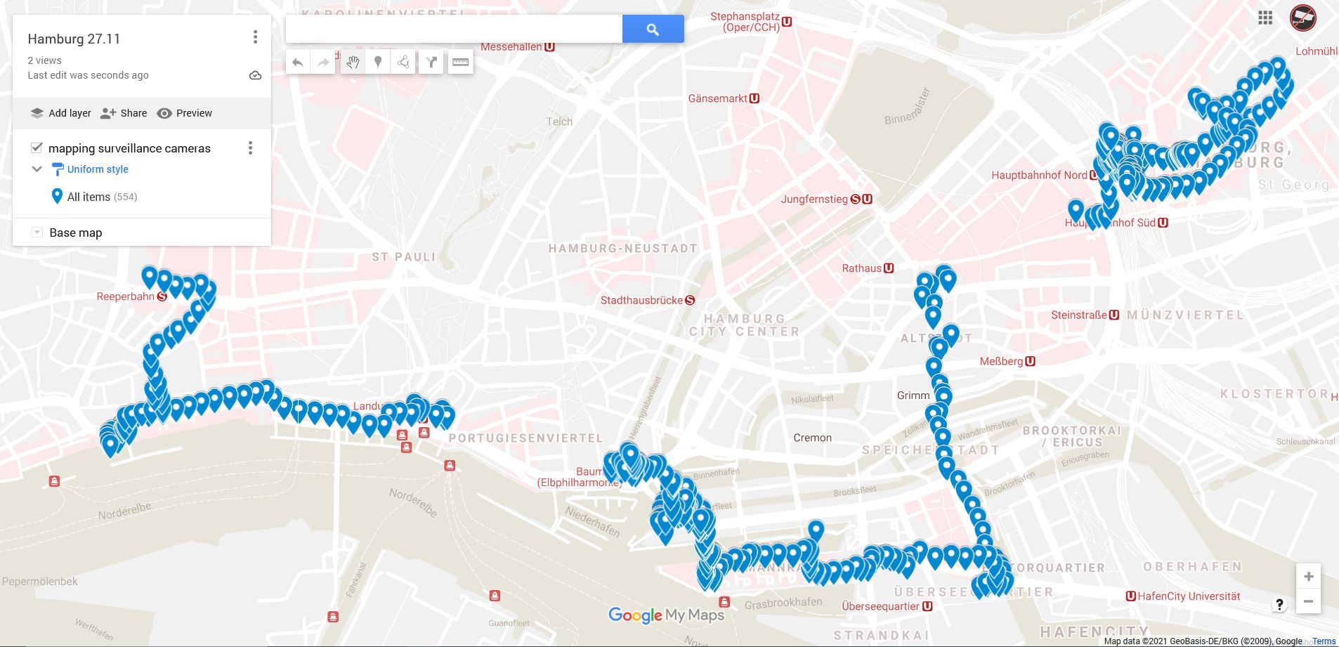
We used unsurv offline on a trip to Hamburg to map public surveillance cameras. This data was saved in a CSV file on the SD card which can be imported to a map service. One of the coming updates will focus on the companion Android app which will be updated to access this data in a privacy friendly way (just like you would read your daily surveillance report).
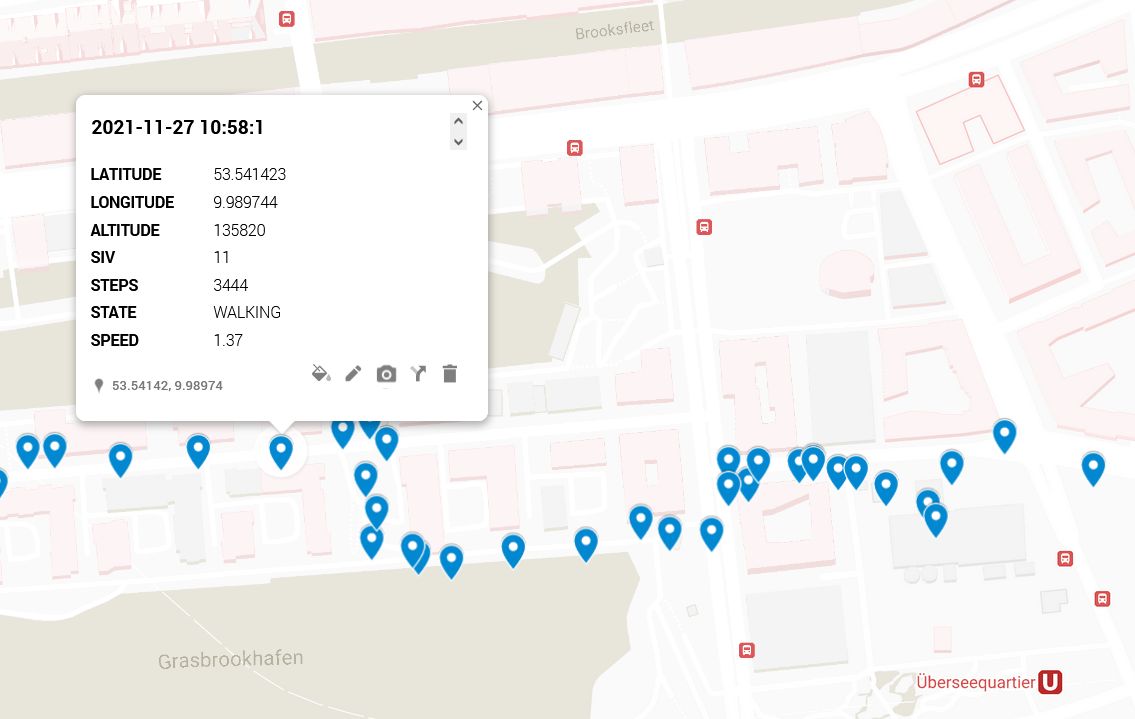
Given the GNSS provided time and the calculated distance between two datapoints, unsurv offline can provide you with an average speed reading in a format of your choice. Further available datapoints include: satellites in view (SIV), total steps, and state. If you prefer riding a bike to being on foot you can rely on the CAM M8 GNSS receiver for measuring your position, distance travelled, and current speed.
We measured a total of 16927 steps over a distance of 12.893 km. Short trips via train were excluded from these calculations. Due to the compact integrated GNSS antenna and no assisting location services based on WiFi or mobile signal enabled, signal reception in a train proves difficult. When exiting the train, normal operation resumes quickly since the device can perform a "hot-start" which only takes seconds to reaquire the GNSS signal instead of the minutes when first booting. In a fitness tracker use case, these generated hops without signal are not counted towards total distance travelled while step counting still works independently on the BMA400.
Thank you very much for your ongoing support. If you have any questions or recommendations contact us via Twitter or the contact form here on Crowd Supply.